
Bicycle Wayfinding System and Guidebook
Across Nova Scotia, communities are taking significant steps to improving and building new cycling and active transportation networks that span municipalities, regions and, in some cases, the entire province. Concurrently, Bicycle Nova Scotia is also actively planning and developing the Blue Route – a 3,000 kilometre provincial cycling network of bicycle routes on rural roads, onstreet bikeway facilities, pathways and trails.
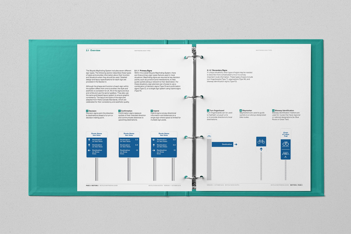
As the quantity, quality and interconnectedness of these facilities has increased over the years, so too has the demand for high quality and consistent wayfinding tools. Recognizing this, Bicycle Nova Scotia and its partners identified a need for consistent guidance, coordination and implementation of wayfinding signs across bicycle route and trail networks in Nova Scotia.
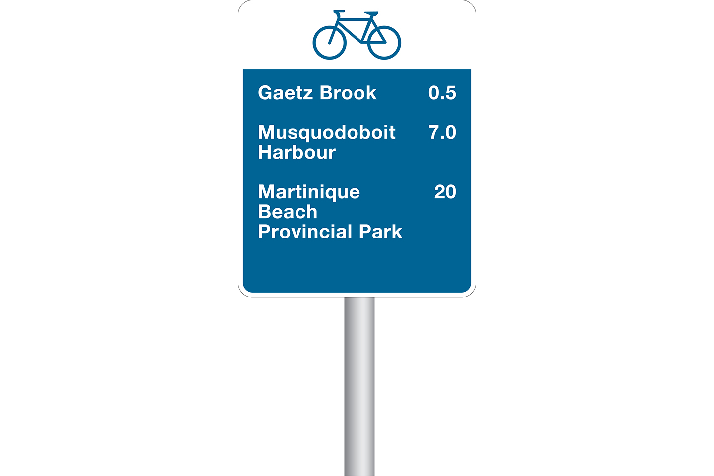
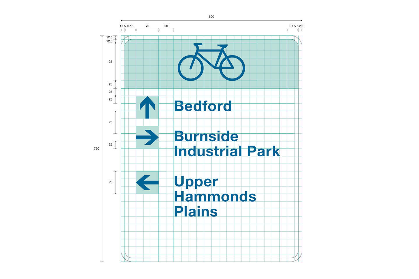
UPLAND worked with Bicycle Nova Scotia to create a bicycle wayfinding system and a supplemental guide that provides easyto- use instructions on how to implement the system. The guide should help route managers collaborate, coordinate and plan their operations to provide an enhanced, user experiences through consistent wayfinding conventions.


| Clients: | Bicycle Nova Scotia, Halifax Regional Municipality |
| Location: | Nova Scotia |
| Service areas: | Parks and Trails, Wayfinding, Signage |
| Start date: | Jan 2018 |
| Finish Date: | Jan 2019 |
| Collaborating: | NA |