
Potlotek First Nation, Land Use Plan
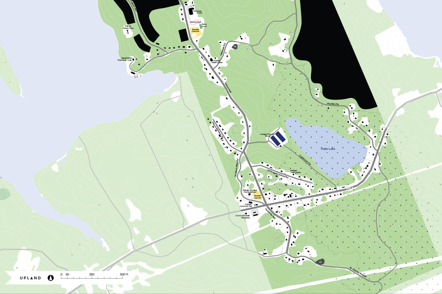
The Potlotek First Nation, also known as Chapel Island First Nation is a Mi’kmaq First Nation in north-eastern Nova Scotia. Situated along Bras d’Or Lake about 10 kilometres east of St. Peter’s on nearly 530 hectares of land, the community has over 500 members living on-reserve and over 120 members off the reserve.
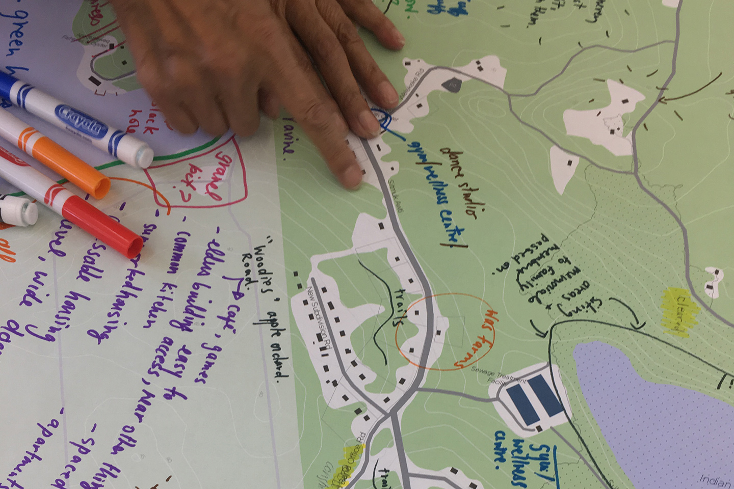
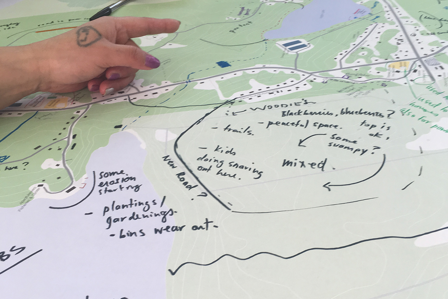
UPLAND and CBCL worked with the band members and the Band Council to create a land use plan that addresses the community’s main priorities and needs for clean potable water and adequate housing.
Together with the band, we created a future land use plan that details eight types of land uses, based on a wide range of parametres related to community well-being, environmental sensitivity, landscape limitations, existing settlement, safety, and economic opportunities.
To address a pressing housing need, our team created a framework to provide a variety of housing types that are appropriate to band members’ individual circumstances, needs, and life phases, including families with children and youth, multi-generational and extended families, seniors, and single adults. The phased 25-year development plan will provide 98 housing units in single dwellings, triplexes and clusters of tiny homes.


| Clients: | Potlotek First Nation via CBCL Limited |
| Location: | Potlotek, NS |
| Service areas: | Urban Design, Community Design, Land Use |
| Start date: | Jan 2017 |
| Finish Date: | Dec 2017 |
| Collaborating: | CBCL Limited |